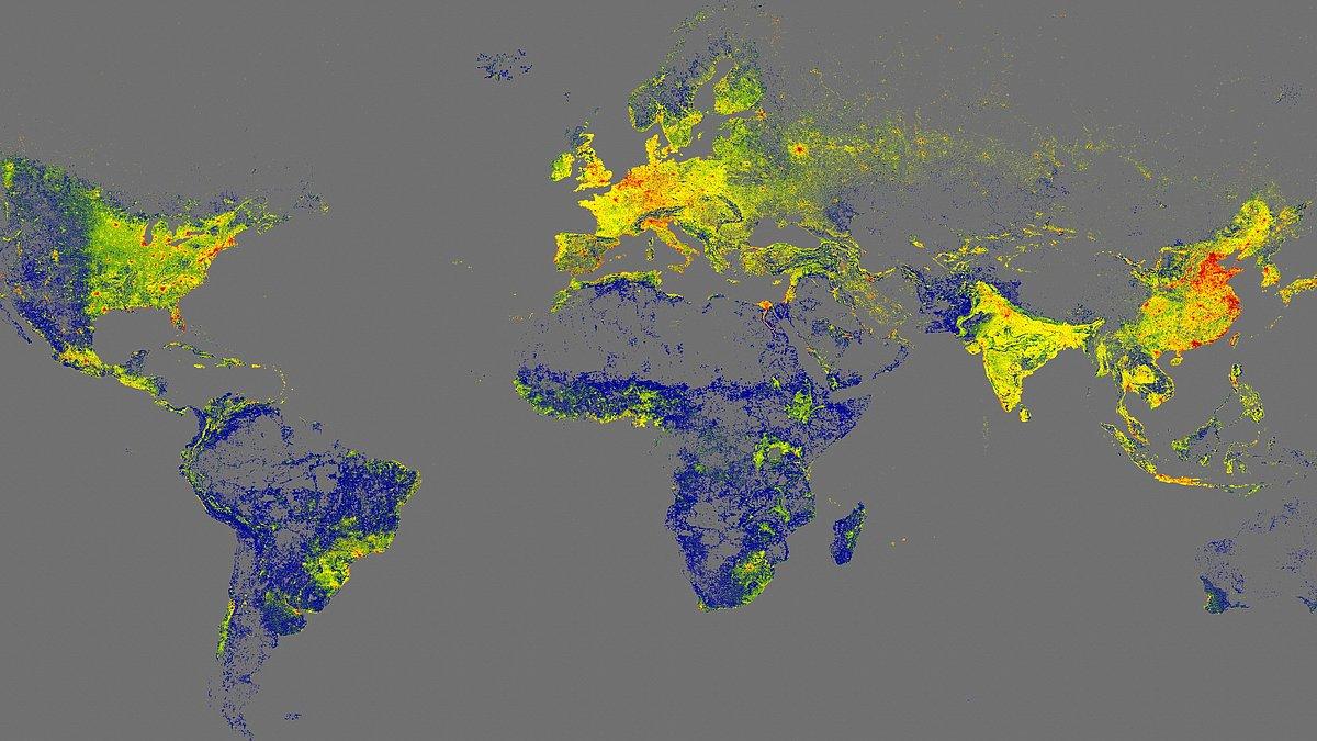
- Global Building Atlas brings together 2,75 billion 3D models of buildings from all over the world.
- The data is open and forms a key basis for climate research and urban planning.
- The 3x3 meter resolution improves accuracy by 30 times compared to comparable databases.
- 97% of the buildings are offered in 3D LoD1 models, useful for urban and infrastructure analysis.
El Global Building Atlas It has become one of the leading international projects for understanding how the planet is built. It is a high-resolution, three-dimensional map that compiles information on billions of buildings in almost every corner of the world, generating a highly accurate snapshot of the urban and rural footprint.
This global atlas, developed by a research team from the Technical University of Munich (TUM)It is based on open data and designed for use by scientists, public administrations, and international organizations. Its objective is to provide a solid foundation for the climate research, infrastructure planning and the assessment of progress towards the UN Sustainable Development Goals.
A 3D atlas that maps all the buildings on the planet
The Global Building Atlas project starts with a seemingly simple but complex question to answer: How many buildings are there on Earth and what do they look like in 3D? To answer this question, the team led by Professor Xiaoxiang Zhu, head of the Chair of Data Science in Earth Observation at TUM, has generated the first high-resolution three-dimensional map covering almost the entire world building stock.
The result is a dataset that brings together 2,75 billion building modelsderived from satellite images from 2019. Each of these models captures the basic shape and height of the buildings, allowing for analysis of the built volume and how the buildings are distributed in urban and rural areas.
This volume of information makes the Global Building Atlas the most extensive collection in its categoryTo give an idea of the magnitude of the leap, the largest global database available until now included around 1,7 billion buildings, that is, one billion fewer than the new atlas developed by the Munich team.
Coverage is not limited to major cities or the most digitized countries. One of the project's highlights is its explicit incorporation regions that were traditionally left out of global maps, such as large areas of Africa, South America and scattered rural areas that rarely appear in conventional cartographic products.
High-precision resolution for urban and climate models
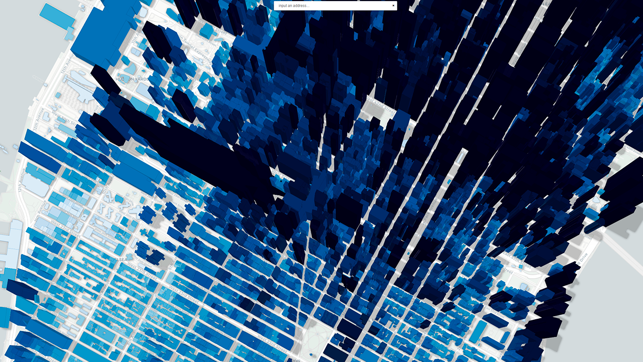
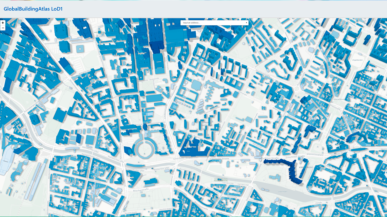
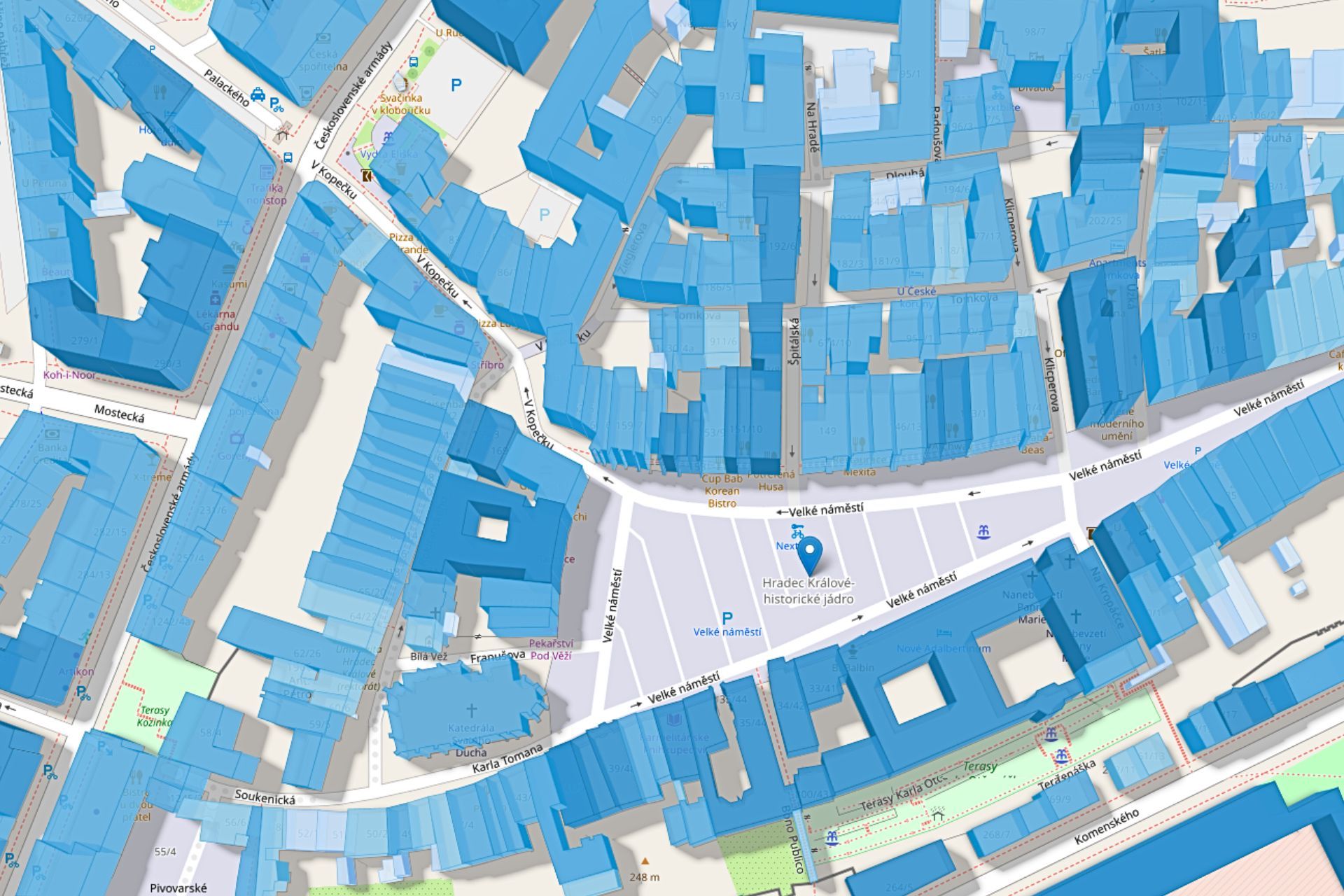
Beyond the volume of buildings, the Global Building Atlas stands out for the spatial resolution of your dataThe models were generated with a cell size of 3×3 meters, representing an improvement of approximately thirty times compared to other comparable global databases. This level of detail allows for a clearer understanding of the overall shape of each building and its relative height.
Thanks to this resolution, it is possible to integrate the atlas into advanced models of urbanization and land useResearchers specializing in urban studies, architects, and public policy officials can use the information to estimate building densities, identify urban expansion patterns, or analyze the relationship between building height and energy consumption.
The added precision also makes a difference in areas such as disaster managementHaving a detailed three-dimensional view of buildings makes it easier to simulate the potential impact of floods, earthquakes, storms, or landslides, helping to prioritize interventions and design evacuation plans that are more closely aligned with the reality of the terrain.
In the European and Spanish context, this type of data can be used to refine plans for adaptation to climate changeFor example, by more accurately assessing which neighborhoods are most vulnerable to heat waves, potential sea level rise, or extreme rainfall events. Having a 3D representation of the buildings makes it easier to cross-reference information with population, income, or age indicators to identify particularly sensitive areas.
LoD1 models: simple, but ready for massive analysis
One of the technical pillars of the Global Building Atlas is the widespread use of 3D models in level of detail 1 (LoD1)This standard describes buildings using simple volumes that capture their basic geometry and height, without going into fine details such as complex roofs, balconies, or facade textures.
According to the TUM team, around 97% of buildings (2,68 billion) The data included in the atlas is offered in LoD1 format. This allows for efficient handling of the dataset in large-scale simulations and analyses, which is essential when working with truly global data.
The choice of LoD1 responds to a balance between detail and computational manageabilityAlthough higher levels of detail exist, which are much richer from a geometric point of view, their generation and storage costs are prohibitive for global coverage. The approach taken is accurate enough for applications such as building volume calculations, residential capacity estimates, or transport and utility infrastructure planning.
For European and Spanish cities, this type of model can be integrated with cadastral data, socioeconomic statistics, or local climate information. This opens the door to more refined studies on... energy efficiency in established neighborhoodsplanning of urban expansion areas or assessment of the impact of new infrastructure on the urban landscape.
Open data in service of the Sustainable Development Goals
A key feature of the Global Building Atlas is its focus on open access to dataThe team from the Technical University of Munich has made the set of 3D models available to the scientific community and public institutions as a common working basis that can feed multiple lines of research and planning projects.
This philosophy fits directly with the needs of organizations like the United Nations, which require reliable and comparable information between countries to track progress towards the Sustainable Development Goals (SDGs). Among other aspects, the atlas facilitates measuring urban sprawl, the density of residential areas, and the proximity of the population to basic services.
In Europe, the availability of a global building map can complement programs such as Copernicus or national land observation initiatives, such as Google Maps with GeminiBy combining the 3D layers of the Global Building Atlas with data on air quality, mobility, or energy consumption, more comprehensive tools are obtained to track the transition towards more sustainable, inclusive and resilient cities.
In the Spanish context, regional and local administrations can take advantage of these types of resources to update territorial diagnoses and to design evidence-based public policies. For example, when planning public transport networks, low-emission zones, or housing rehabilitation strategies, having a three-dimensional layer of the building stock is especially useful.
Applications in urban planning, infrastructure and risk management
The range of uses for the Global Building Atlas is broad and encompasses everything from the academic research even the day-to-day management of cities. In the field of urban planning, 3D models allow for a quick overview of the morphology of entire neighborhoods, the identification of areas with a high concentration of buildings, and the detection of land reserves still available for new developments.
Information on the volume and height of buildings is also valuable for the infrastructure planningTransport, electricity distribution, water and sanitation or telecommunications networks can be more accurately sized if the distribution of buildings and the potential population that can be concentrated in each area are known in detail.
In terms of risk management, the three-dimensional representation of the building stock serves as support for simulate emergency scenariosFlood models, extreme wind analyses, or seismic risk studies gain in realism when they incorporate the shape and height of buildings, especially in dense urban environments where the arrangement of buildings conditions the spread of damage.
European researchers and technicians can combine the Global Building Atlas with other regional databases to refine their assessments. In the case of Spanish cities exposed to torrential rain events, for example, integrating 3D building models into hydrological simulations helps to identify problems in greater detail. critical water accumulation points or possible obstacles to natural drainage.
All of this makes the atlas a flexible tool that, without being tied to a single field of study, provides a structural information layer very powerful on which to build diverse sectoral analyses.
With a combination of global scale, high resolution, and Level of Development (LoD1) models geared towards massive analysis, the Global Building Atlas positions itself as a pieza central For those who need to understand how buildings are distributed and evolve across the planet, its open data nature, its focus on traditionally underrepresented regions, and its potential to improve both climate research and urban management make it a particularly relevant resource for Europe and Spain, where territorial planning and adaptation to climate change increasingly demand decisions based on solid evidence.

I am a technology enthusiast who has turned his "geek" interests into a profession. I have spent more than 10 years of my life using cutting-edge technology and tinkering with all kinds of programs out of pure curiosity. Now I have specialized in computer technology and video games. This is because for more than 5 years I have been writing for various websites on technology and video games, creating articles that seek to give you the information you need in a language that is understandable to everyone.
If you have any questions, my knowledge ranges from everything related to the Windows operating system as well as Android for mobile phones. And my commitment is to you, I am always willing to spend a few minutes and help you resolve any questions you may have in this internet world.